Loveland Pass Summit
U.S. Route 6 runs east-west across Colorado. From the 1940s into the 1960s it was the main route for skiers going from Denver to Aspen, Vail, or other Colorado ski areas. For many of us Easterners, Route 6 was our introduction to Rocky Mountain winter driving.
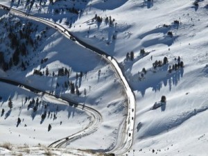
U.S. 6 climbs steadily from Denver. After about 60 miles you come to Loveland Ski Area at an elevation of 11,000 feet. And then the fun begins. The road takes a series of hairpin switchbacks that lead to Loveland Pass. One of the first switchbacks goes through the Seven Sisters – seven very active avalanche paths. These occasionally cause the road to be closed either because of avalanches or because avalanche control is in progress.
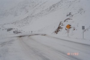
In a good winter the road surface through the pass is packed snow. In fact up until this past weekend’s storm some of our trail surfaces were reminiscent of the Loveland Pass road surface. Although in fairness they do sand the Loveland Pass road.

Looking Back at Where You Were
As you approach the summit the trees thin out and you can look down the steep slopes and see where you started – and there are no guard rails! On my first trip through the pass there was a state snowplow that had gone off the road during an earlier storm and was partly buried on the slope between switchbacks. I’m sure it stayed there until spring!
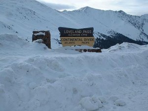
The summit of Loveland Pass crosses the Continental Divide at 11,990 feet making it the highest winter-maintained pass in the United States. On a good day the views are spectacular from the summit.
On the Western side of Loveland Pass, U.S. 6 descends through more switchbacks in open, snowy, alpine terrain. On cloudy days flat light is a problem on this side. It’s not unusual to see drivers using their ski goggles to get better definition. There’s a great view of Arapahoe Basin Ski Area as you descend.
Most people who have taken multiple trips through Loveland Pass have tales of road closures, chain-laws in effect, whiteouts, or other adventures.
However all that changed in 1973 with the opening of the Eisenhower Tunnel. By then Interstate 70 had been completed right up to the Loveland Ski Area and the tunnel provided a bypass for Loveland Pass.
John Ahern correctly answered last week’s trivia having used the tunnel in the spring of 1973. “It was two-way traffic and SLOW but better than the surprises that the ‘pass’ always seemed to throw at you. “
The second tube of the tunnel was completed in 1979 providing separate east and west tunnels. John also correctly pointed out that technically only the original west-bound tunnel is the Eisenhower. The east-bound is the Johnson tunnel named for former Colorado Governor Edwin Johnson.
The tunnels are 1.7 miles in length and at the time they were built were the highest vehicular tunnels in the world.
The completion of the tunnels boosted development on the western side. Summit County, as it is now called, became a year-round recreational mecca. In the winter there are Breckenridge, Copper, Keystone, and A-Basin ski areas. In the summer there is Lake Dillon providing a variety of water sports. Lake Dillon is actually a reservoir that supplies drinking water to Denver.

Loveland Pass Road Conditions
U.S. Route 6 through Loveland Pass is still available as a scenic alternative to the tunnel. Actually vehicles carrying hazardous materials have to use Route 6 rather than the tunnel which adds one more hazard to the Loveland Pass list.
Loveland Pass is popular for backcountry skiing these days. It offers the ability to catch a ride up rather than hike to access legitimate backcountry routes.
While there’s no denying the convenience of the tunnel, it’s not the same for first timers as Loveland Pass. There was something about that “white knuckle” drive that added to the overall experience and made it memorable.

January 9, 2014 at 7:13 am
Went through the tunnel 4 times the day it opened in 1973. The first weekend it was available to use we had a snow storm and the grade up to the tunnel was too slippery and traffic had to be routed over the pass. When I travel I70 I always go over the pass. The tunnel is long and boring.
August 6, 2014 at 8:55 pm
“While there’s no denying the convenience of the tunnel, it’s not the same for first timers as Loveland Pass. There was something about that “white knuckle” drive that added to the overall experience and made it memorable.”
I don’t know. Even WITH the tunnel, that drive could be a white knuckle experience. I was heading to Vail in March ’76 with my family and had to pass a Coors Beer semi that had jack knifed into the mountain. Cars were passing one at a time to the left and we came waaaaay too close to the dropoff. My Dad’s knuckles were plenty white on the steering wheel getting by that truck and back on the road again.